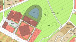
LOCAL PLANS
- Plan boundaries (visible by default, new items are marked with icon
 )
) - Plan drawings.
- Detailed regulations on planned land use (turned off by default).
- Plan search.
- Plan details.
- Citywide, premade analyses on planned land use.
- Symbols on the map
Plan regulations in vector form
In addition to viewing individual plans and their drawings we provide you with another way of exploring our local plans database
"Plan regulations" layer allows you to browse all the local plans seamlessly in unified, vector form
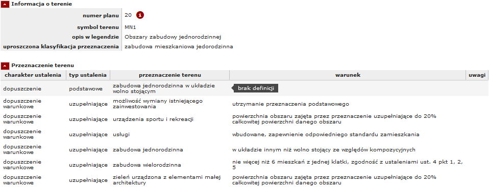
Detailed regulations on planned land use
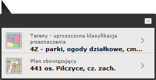
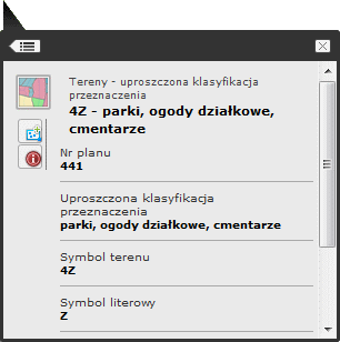
To access this information you need to activate "Land use (simplified)" layer first. Then you can identify individual zones and view detailed infomation.
Relevant information in under "Tereny - uproszczona klasyfikacja przeznaczenia" in the popup window and  icon in top right corner.
It is not translated to english, however in addition to polish definitions of planned land use we provide you with classification in accordance with HILUCS standard.
Note on "Plan regulations" layer
This data is not to be treated as a replacement for traditional printouts of individual plans. It is by definition processed and therefore altered.
For this reason it no longer has any legal force.
Plan details
Detailed information on local plan is avaiable upon identification of any item on "Local plans - plan boundaries" layer
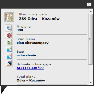
Tools description:
 - Zoom to plan extent
 - Additional information (in polish)
 - Export as table
 - Add to selection
 - Remove from selection
 - Show/hide plan drawing ("Rysunek" - show drawing clipped to plan area, "Legenda" - show only map legend, "Oryginał" show entire drawing with legend, frame and surroundings
You may need to disable any layers you activated before the drawings become visible.
Citywide, premade analyses on planned land use
Layer group "Assignment analysis" presents a set of premade analyses on our planned land use database. The layers show local plan zones where analysed function is permitted.
- residential
- residential – single-family housing
- residential – multi-family housing
- services
- retail trade to 2000 m2 »
- retail trade over 2000 m2 »
- education
- nurseries
- hotels
- allotment gardens
- medical consultation
- hospitals
- exhibitions
- art workshops
- cultural activities (libraries, culture centers, clubs etc)
- outdoors events infrastructure
- large cultural activities (cinemas, theaters, circuses, planetaria etc)
- social care »
- collective accommodation establishments »
- outdoor sport equipment »
- indoor sport equipment »
Data update on a regular basis.
Symbols on the map
News
 nowości - nowe przystąpienia
 nowości - rozpoczęcie etapów opiniowania i uzgadniania
 nowości - nowe uchwalenia
Collecting applications for projects 
Upon commencing work on local plan a period of collecting applications begins. It usually lasts for a couple of weeks and the end date is visible after identification of the icon
Public expositions / public consultations 
After initial work on plan project it is set forth for public exposition. This starts a period of collecting reviews. You can view relevant dates after identification of the icon:
- wyłożenia
- konsultacje społeczne
Legal appeals 

This group of entries can represent each of these states:
- wezwanie przedskargowe – an inquiry regarding the plan has been filed and is under proceedings
- postępowanie sądowe – a plan is under court proceedings
- wyrok unieważniający – a plan or its part was invalided by a court order
- rozstrzygnięcie nadzorcze – a plan or its part was invalidated by Voivodeship


